OS1/29/7/65


| List of names as written | Various modes of spelling | Authorities for spelling | Situation | Description remarks |
|---|---|---|---|---|
| HARDEN HILL | Harden Hill Harden Hill |
Andrew Stavert Farmer DyKecrofts William Keir Farmer Whitthaugh |
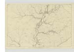
045 | [Situation] 1/2 mile nearly East of the Caddrouns. A Considerable hill the Surface of which is Covered with Heathy Pasture on the farm of DyKecrofts; having a Trigl. [Trigonometrical] Station on its summit. |
| YELLOW SIKE | Yellow Sike Yellow Sike |
Andrew Stavert Farmer DyKecrofts William Keir Farmer Whitthaugh |
045 | [Situation] East of Harden Hill. A Small burn having its Source about 16 chains east of Harden Hill flowing in a Southerly direction and empties itself into Tweeden Burn |
| TWEEDEN BURN | Tweeden Burn Tweeden Burn |
Andrew Stavert Farmer DyKecrofts William Keir Farmer Whitthaugh |
045 | [Situation] From the East of Watch Craig S.E. [South East] to Liddel Water. A large burn having its Source at Goose Rig flowing in a South Westerly direction and empties itself into the River Liddel near the Greens, Farm, |
Continued entries/extra info
[Page] 65Parish of Castleton -- Sheet 45. 8. -- [Trace] 3
[signed] John McDowell Sapr R E [Sapper Royal Engineers]
Transcribers who have contributed to this page.
Moira L- Moderator, Douglas Montgomery
Location information for this page.
Linked mapsheets.