OS1/29/5/91


| List of names as written | Various modes of spelling | Authorities for spelling | Situation | Description remarks |
|---|---|---|---|---|
| FANNA HILL | Fanna Heights Fanna Heights Fanna Heights Fanna Heights Fanna Hill Fanna Hill Fanna Hill |
James Elliot Archibald Stavert James Telfer Property Documents Blackwoods Co. [County] Map Gazetteer of Scotland Jeffrey's History of Roxburgh |
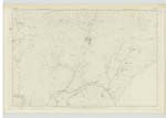
039 | [Situation] On the boundary between Hobkirk and Castleton. A large ridge on the farm of Saughtree; extending a distance of about 3 miles. it is about 1500 feet above sea level. Hill to be adopted on Plans this height being one of the summits of what is often considered the Cheviot range - not in itself a chain of hills as the name heights would imply. |
| FANNA BOG | Fanna Bog Fanna Bog |
James Elliot Archibald Stavert |
039 | [Situation] 1 Mile N.E. [North East] of Fanna Heights A wet patch of land on the farm of Singden. |
| CUTTIT SIKE | Cuttit Sike Cuttit Sike |
James Elliot Archibald Stavert |
039 | [Situation] 10 chains S.W. [South West] of Fanna Bog A small stream rising on Fanna Heights & falling into Lang Grain. |
| SINGDEN BURN | Singden Burn Singden Burn |
James Elliot Archibald Stavert |
039 | [Situation] 30 Chains s.E [South East] of Fanna Bog. S [South] to Caddroun Burn. A large stream flowing from the Confluence of Lang Grain & Swire Sike & falling into Cauldron Burn |
Continued entries/extra info
[Page] 91Parish of Castleton
Sheet 39 Trace 1
[Signed] P McHugh
Lce. Corp. R.E. [Lance Corporal Royal Engineers]
Transcribers who have contributed to this page.
Skinnb1- Moderator, John Dunlop
Location information for this page.
Linked mapsheets.