OS1/29/5/111


| List of names as written | Various modes of spelling | Authorities for spelling | Situation | Description remarks |
|---|---|---|---|---|
| SAUGHTREE FELL | Saughtree Fell Saughtree Fell Saughtree Fell |
James Elliot. James Telfer, Schoolmaster. Archibald Stavert. |
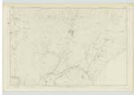
039 | [Situation] 40 chains South of Berry Knowe. A very large ridge on the farm of Saughtree, about 1500 feet above sea level. |
| DOROTHY SIKE | Dorothy Sike Dorothy Sike |
James Elliot Archibald Stavert. |
039.09 | [Situation] N.W. [North West] of Saughtree Fell. A small stream rising from Saughtree Fell & falling into Alison Sike. |
| ABBEY SIKE | Abbey Sike Abbey Sike |
James Elliot. Archibald Stavert. |
039 | [Situation] East of Abbey Knowe. A small stream rising from Coopercleuch Knowe & falling into Daston Burn. |
| SAUGHIE SIKES | Saughie Sikes Saughie Sikes |
James Elliot Archibald Stavert |
039 | {Situation] East of Cadroun Burn Two small stream rising at the base of Dod Fell & falling into Caudron Burn |
| DAWSTON BURN | Daston Burn Daston Burn Daston Burn Dawstone Burn Dawstane Dawstane |
James Elliot. Estate Map. Archibald Stavert. Johnston's County Map Impl [Imperial] Gazeteer of Scotland. Valuation Rolls. |
039.14 | [Situation] from the junction of Cliffhope Burn and Alison Sike S.E. [South East] to Liddel Water. A large stream flowing from the confluence of Cliffhope Burn & Alison Sike & falling into Liddel Water. |
Continued entries/extra info
[Page] 111Parish of Castleton
Sheet 39 Trace 3
[signed] P McHugh Lce Cpl [Lance Corporal] R E [Royal Engineers]
Transcribers who have contributed to this page.
Skinnb1- Moderator, John Dunlop
Location information for this page.
Linked mapsheets.