OS1/28/35/14


| List of names as written | Various modes of spelling | Authorities for spelling | Situation | Description remarks |
|---|---|---|---|---|
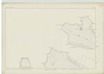
| STATTIC POINT | Stattic Point | Alexander McKenzie Badluchrach John McKenzie Scoraig Donald McIver Scoraig Admiralty Chart |
012 | Applies to a point of land between Gruniard Bay & Little Loch Broom about 1 1/4 miles W. [West] of Scoraig |
| CÀRN DEARG AILEIN | Càrn Dearg Ailein | Alexander McKenzie Badluchrach John McKenzie Scoraig Donald McIver Scoraig Admiralty Chart |
012 | Applies to a large hill about 1/2 mile S [South] of Stattic point & 1 1/2 miles N.W. [North West] of Badluchrach. Sig [Signification] "Allen's red Cairn" |
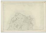
| CÀRN DEARG NA H-UAMHA | Càrn Dearg na h-Uamha | Alexander McKenzie Badluchrach John McKenzie Scoraig Donald McIver Scoraig Admiralty Chart |
012 | Applies to a hill about 1/2 a mile s [south] of Càrn Dearg Ailein & 1 1/2 miles W. ][West] of Badluchrach Sig [Signification] Red Cairn of the Cave |
| CNOC NA H-IOLAIRE | Cnoc na h-Iolaire | Alexander McKenzie Badluchrach John McKenzie Scoraig Donald McIver Scoraig Admiralty Chart |
012 | Applies to a Knoll about 1/2 a mile S.E. [South East] of Stattic point, 1/2 a mile N.E [North East] of Carn Dearg Ailean and 3/4 of a mile N.W. [North West] of Badluchrach Sig [signification] "Knoll of the Eagle" |
Continued entries/extra info
[Page] 14Sheet 12 -- Parish of Lochbroom -- Co [County] Ross
[Pencil Note Stattic Point] -- Admiralty Chart
[Signed] T. Gilloloey
C.A. [Civilian Assistant]
Transcribers who have contributed to this page.
Moira L- Moderator
Location information for this page.