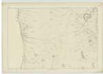
OS1/28/12/59
| List of names as written | Various modes of spelling | Authorities for spelling | Situation | Description remarks |
|---|---|---|---|---|
| SGARTAN RUADH | Sgartan Ruadh | M. McKenzie Peterburn | 031 | A rocky face situated between Druim a' Gharaidh and Geodh Dhomhnuill Uisdein Sig. [Signification] "Little red fissure". |
| GEODH' DHOMHNUILL UISDEIN | Geodh Dhomhnuill Uisdein | M. McKenzie Peterburn | 031 | A Creek situated west of Sgartan Ruadh Sig. [Signification] "Creek of Donald Hugh". |
| AN T-EAS | An t-Eas | M. McKenzie Peterburn | 031 | A small waterfall at the junction of Allt a' Bhutha with the Minch Sig. [Signification] "The Waterfall". |
| LEAC AN EASA | Leac an Easa | M. McKenzie Peterburn | 031 | A flat rock on the north side of An t-Eas Sig. [Signification] "Flag of the Waterfall". |
Continued entries/extra info
[Page] 59Ph. [Parish] of Gairloch -- County of Ross
2.
[Signed] John Durran
Sapper R.E. [Royal Engineers]
Transcribers who have contributed to this page.
Kate51- Moderator, Bizzy- Moderator
Location information for this page.


