OS1/27/1/55


| List of names as written | Various modes of spelling | Authorities for spelling | Situation | Description remarks |
|---|---|---|---|---|
| DÀIL O DHEAS | Dàil O Dheas | Donald McFarlane Galston Informant could not spell John Morrison, Ord. [Ordnance] Survey |
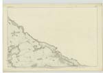
002 | A Small Village of huts, built of Stone and peat and thatched with straw, along the East End of which the Stornoway and Ness road passes. It is situated in a patch of good arable land and has some moorland attached. |
| AMHUINN DHÀIL | Amhuinn Dhàil | Donald McFarlane Galston Informant could not spell John Morrison, Ord. [Ordnance] Survey |
002 | A small river which flows out of Loch Langabhat into the sea at Airnistean, and in its course separates Dail O Dheas from Dail O Thuath. It is about five miles long. |
| AIRNISTEAN | Airnistean | Donald McFarlane Galston Informant could not spell John Morrison, Ord. [Ordnance] Survey |
002 | A small hill and headland on the Sea Coast at the mouth of Amhuinn Dail. It is tolerably prominent, is composed of arable land, and has three or four enclosures on it. |
Continued entries/extra info
[Page] 55Plan 2 D List of Names collected by 2nd Corpl. [Corporal] Hayes
Township or Parish - Barvas
Objects
Dàil O Dheas - Village
Amhuinn Dhàil - stream
Airnistean - headland
[Page signed] Michael Hayes
2nd Corpl. RS&M [Corporal Royal Sappers and Miners]
29th March 52
Transcribers who have contributed to this page.
Bizzy- Moderator, eilthireach
Location information for this page.