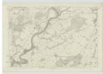
OS1/25/74/1
| List of names as written | Various modes of spelling | Authorities for spelling | Situation | Description remarks |
|---|---|---|---|---|
| ST MARTINS [parish] | St. Martin's St. Martin's St. Martin's St. Martin's St. Martin's St. Martin's St. Martin's St. Martin's St. Martin's St. Martin's St. Martin's |
Old Statistical Account New Statistical Account Fullarton's Gazeteer Chalmer's Caledonia Sheriff's Returns Wilson's Archaelogy Estate Plans Johnstone's County Map The Revd [Reverend] Mr. Park Ph [Parish] Minister County Directory of Scotland Valuation Roll |
074 ; 086 | "The parishes of St. Martins & Cambusmichael were united about 150 years ago, and took their names from the two saints to whom they were dedicated Cambus in the Gaelic language, signifies a low plain, and is descriptive of the situation of the Old Parish Church of Cambusmichael, as it lies in a plain on the banks of the Tay. The ruins of the Church of Cambusmichael still remain, but the name of that parish is lost in that of St. Martin's which now forms the Designation of both parishes. It is bounded on the North by the parish of Cargill; on the North-West by the parish of Auchtergaven; on the West by the parish of Redgorton; on the South-west by the parish of Scone; on the North-east by the parish of Collace; on the East by a detached portion of Kettins Ph. [Parish] belonging to Forfarshire; on the South-East by a detached portion of Kinnoul Ph .[Parish] and the parish of Kilspindie. The River Tay forms its western boundary which divides it from the parishes of Auchtergaven and Redgorton." New Stat [Statistical] Account. |
Continued entries/extra info
[Page] 1Transcribers who have contributed to this page.
Trondragirl- Moderator, GMB
Location information for this page.


