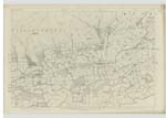
OS1/25/61/35
| List of names as written | Various modes of spelling | Authorities for spelling | Situation | Description remarks |
|---|---|---|---|---|
| MUCKART MILL (Corn & Flour) | Muckart Mill (Corn & Flour) Muckart Mill (Corn & Flour) Muckart Mill (Corn & Flour) Mill of Muckart |
Archibald Young Occupier John Drysdale Dollar Joseph Martin Muckart Stobies Co. [County] map |
134 | [Situation] In the South end of the parish close to the boundary An extensive Corn Mill situated on the banks of the Devon, about 2 miles south west from the Pool of Muckart, and driven by the Hole Burn. The property of Alexander Haig Esqre. of Blairhill. |
| BOGHALL | Boghall Boghall Boghall Boghall |
John Allan Occupier Val [Valuation] Roll 1858-59 Mr. Sinclair Schoolmaster Stobie's Co. [County] map |
134 | [Situation] In the South end of the parish A farm steading consisting of a substantial dwellinghouse with convenient outhouses attatched. |
| VICAR'S BRIDGE | Vicar's Bridge Vicar's Bridge Vicar's Bridge Vicar's Bridge |
Mr. Allan Boghall Joseph Martin Muckart William Christie Wester Caplawhead John Drysdale Dollar |
134 | [Situation] On the boundary in the South end of the parish A plain substantial bridge of one arch spanning the Devon, about 2½ miles from the Village of Muckart. There is an inscription on it, as follows: "Sacred to the memory of Thomas Forrest the worthy Vicar of Dollar, who among other acts of benevolence built this bridge. He died a martyr A.D. [Anno Domini] 1538." |
Continued entries/extra info
[Page] 35Sheet 134 Plan 8 -- Traces 3, 4, & 5 Parish of Muckart
VICAR'S BRIDGE
"The Vicar's Bridge is supposed to derive its name from an event that took place at
the Commencement of the Reformation. It was there where the vicar of Dollar who had
embraced the Protestant faith met with an untimely end from the hands of his persecutors" New Stat. Acct. [Statistical Account]
"The vicar's Bridge leading from the north to the Coal at Blairingone said to be built by a Vicar who once lived
at Dollar but in what year is uncertain. It was widened 6 feet about 30 years ago." Old Stat. Acct. [[Statistical Account] Vol. [Volume] 18 p []
Transcribers who have contributed to this page.
Trondragirl- Moderator, Brenda Pollock
Location information for this page.
Linked mapsheets.


