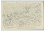
OS1/25/61/21
| List of names as written | Various modes of spelling | Authorities for spelling | Situation | Description remarks |
|---|---|---|---|---|
| WESTBURN | Westburn Westburn Westburn Eastburn |
Henry Sinclair, Schoolmaster Valuation Roll 1857-1858 Charles Ferguson Stobie's Co. [County] Map |
134 | [Situation In the west side of the parish close to the boundary A small one storey house with pendicle of land attached, occupied by the proprietor, Charles Ferguson. |
| LAWHILL | Lawhill Lawhill Lawhill |
Hnery Sinclair, Schoolmaster Valuation Roll 1857.1858 John McArthur Moir |
134 | [Situation] In the west side of the parish A two Storey farm house with outhouses attached all in good repair. The property of John McArthur Moir - Hillyend. |
| KELLY BURN | Kelly Burn Kelly Burn Kelly Burn |
Henry Sinclair John McArthur Moirr Charles Ferguson |
134 | [Situation] Forming part of the west boundary of the parish A small burn that rises between Commonedge and Gloom Hill, it forms the western boundary of the Parish, and runs in a southern direction until it joins the River Devon |
Continued entries/extra info
[Page] 21Ph. [Parish] of Muckart -- Sheet 134 No. 3 Trace 1 & 2
[Signed] N Bartlett Sapper R.E. [Royal Engineers]
Transcribers who have contributed to this page.
Trondragirl- Moderator, Brenda Pollock
Location information for this page.
Linked mapsheets.


