OS1/25/38/1
| List of names as written | Various modes of spelling | Authorities for spelling | Situation | Description remarks |
|---|---|---|---|---|
| KILSPINDIE [parish] | Kilspindie Kilspindie Kilspindie Kilspindie Kilspindie Kilspindy Kilspindy |
New Statistical Account Old Statistical Account Fullarton's Gazetteer of Scotland Oliver and Boyd's Almanack Ainslie's County Map dated 1789 Stobie's County Map Johnston's County Map |
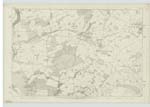
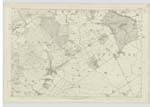
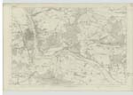
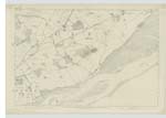
086 ; 087 ; 098 ; 099 | The parish of Kilspindie is in the Presbytery of Perth, Synod of Perth and Stirling. There were originally two parishes, Kilspindie and Rait; but at what period their union took place, has not been ascertained; it must have been prior to 1634. The walls of the Church of Rait are still standing. The parish of Kilspindie is bounded on the west by two detached parts Nos.1 & 3 of Kinnoul Parish, by Scone Parish, and St. Martins parish; on the north and north east, by St. Martin's parish, by a detached part of Caputh parish and by Kinnaird parish; on the east by the parish of Errol and on the south by the parish of Kinfauns. The parish lies partly in the Carse of Gowrie, and partly among the Sidlaw Hills, about halfway between Perth and Dundee. The general appearance of the ground is pleasing, and presents to the eye an agreeable variety of moor and cultivated land. Towards the southern extremity, the ground is flat; at about a quarter of a mile farther north, it rises with a slope, for two miles, till it reaches an elevation of more than 600 feet; intersected in three different places by the burns of Rait, Kilspindie, and Pitroddie. The remaining part has a northern aspect. Agriculture is in a flourishing state and the system of [continued on page 2] |
Continued entries/extra info
[Page] 1Parish of Kilspindie
Transcribers who have contributed to this page.
Alison James- Moderator, Brenda Pollock
Location information for this page.


