OS1/25/26/115


| List of names as written | Various modes of spelling | Authorities for spelling | Situation | Description remarks |
|---|---|---|---|---|
| CLATTERINGFORD BURN | Clatteringford Burn Clatteringford Burn Clatteringford Burn |
John Dougall Senr. [Senior] John Dougall Junr. [Junior] John Cunningham |
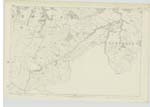
119 | [Situation] In the Southern portion of the parish A Small Stream which takes its rise at the foot of the east side of Skymore Hill. The name applies from its source to its junction with Thorter Burn a short distance east of Knowes Farm Steading. |
| COWS MOSS | Cows Moss Cows Moss |
William Bain Robert Irvine, Blaeberry Toll |
119 | [Situation] In the S. [South] portion of the parish A small patch of wet ground covered with rough pasture; formerly a peat moss. |
| SKYMORE HILL | SKymore Hill SKymore Hill SKymore Hill |
William Davidson John Dougall Senr. [Senior] John Dougall Junr. [Junior] |
119 | [Situation] In the Southern portion of the parish A lofty pastural eminence situated on Cockerdfauld Farm, and is a component part of the Ochil Hills There is a Trigl. [Trigonometrical] on its summit. |
| DUNNING BURN | Dunning Burn Dunning Burn |
William Bain. William Oswald. |
119 | [Situation] In the S. [South] portion of the parish A large stream having its source at the Confluence of Thorter Burn & Clatteringford Burn: it flows from that in a northerly direction & falls into the River Earn. |
Continued entries/extra info
[Page] 115Parish of Dunning -- Plan 119-5 Trace 3 & 6
[Note ]
CLATTERINGFORD BURN
This ford from which the name is
derived was filled up, when the
present Turnpike Road was
constructed.
Transcribers who have contributed to this page.
Trondragirl- Moderator, Molly Miller
Location information for this page.
Linked mapsheets.