OS1/25/15/1


| List of names as written | Various modes of spelling | Authorities for spelling | Situation | Description remarks |
|---|---|---|---|---|
| CARGILL [parish] | Cargill Cargill Cargill Cargill Cargill Cargill Cargill Cargill Cargill |
Old Stat: [Statistical] Account New Stat: [Statistical] Account Fullarton's Gazetteer Chalmer's Caledonia Mr. James Macbeth Factor Estate Plans Valuation Roll Pennant's Tour of 1772 Johnstone's Coy. [County] Map |
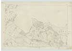
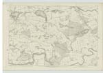
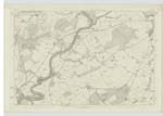
063 ; 074 ; 075 | "The name of this parish is from Caer, signifying in the Celtic language a village, and Cill, a place of worship, or burial. It was formerly called West Parish, and is said to have been part of the parish of Coupar Angus, but has long since been disjoined from that, and erected into a distinct parochial district. Bishop Spottiswood mentions, that, as far back as the year 1514, Andrew Stuart, brother to John Earl of Athole, got the benefices of Cargill and Alyth. This parish is situated in the large vale of Strathmore, and is bounded on the north, by the River Isla; on the east by Kettins; on the south-east, by Longforgan and Abernythe; on the south by St. Martins and Collace; and on the west by the River Tay. There are four villages in the parish Woodside, Burrelton, Wolfhill and Cargill. the main line of railway to Aberdeen, known as the Scottish North Eastern, runs through the northern extremity of this Parish The only Antiquities are the supposed Roman Station at Castlehill, Vestiges of the Roman Road, the Ancient Mansion-house of Stobhall, Macbeth's Law, Standing Stones &c &c." New Stat: [Statistical] Account. |
Continued entries/extra info
Page 1[Note:]
There is a portion of this parish detached
but a detached portion of Scone Ph. [Parish] is contained
within the boundary of this Parish.
Transcribers who have contributed to this page.
Alison James- Moderator, GMB
Location information for this page.