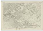
OS1/25/13/81
| List of names as written | Various modes of spelling | Authorities for spelling | Situation | Description remarks |
|---|---|---|---|---|
| RIVER TAY | River Tay River Tay River Tay |
R. C. Carrington Esqr. Revd [Reverend] John Wilson Revd. [Reverend] Daniel McBride |
062 | " A river draining the greater part of Perthshire and passing off to the sea between Forfarshire and Fifeshire. It issues from Loch Tay, or rather begins there to take its name of the Tay; but it is really formed by two great head streams which rise among the Grampians on the mutual border of Perthshire and Argyleshire. The northern stream bears successively the names of the Garrie, the Rannoch, and the Tummel; and in its progress, it forms, by the expansion of its waters, the three great lakes Lydoch, Rannoch, and Tummel. **** The southern one of the great head streams bears successively the names of the Fillan, the Dochart, and the Tay; and traverses, in its progress, Loch Dochart and Loch Tay. It rises on the side of Benloy, at the boundary of Killin with Argyleshire 7 miles in a straight line north-north-west of the head of Loch Lomond; and, measured in straight lines and through its lakes, to its junction with the Tummel, it performs a run of about 57miles. *** From the lower end of Loch-Tay to its junction with the Tummel, a distance of about 14 or 15 miles, it traverses the east end of Kenmore, washes isolated districts of Dull, Fortingal, Logierait, and Weem, and divides the main body of Logierait on its left bank from Little Dunkeld on its right. From its junction with the Tummel to its junction with the Earn, where it begins to expand its estuary, it achieves, irrespective of similarities, a distance of 32 miles, in alternate directions of 6 southward and 11 eastward, and of 11 southward and 5 eastward; *** Its entirely length of course, jointly as a river and as an estuary, is thus, if measured in straight lines from the head of the Garrie, 118 miles, - of its measurement in the same way from the head of the Fillan, 115 miles - and if measured along its channel from either of the remote sources, between 160 and 200 miles. *** The extent of the surface drained by the Tay and its tributaries is variously computed at 2396, 2750 square miles, and that of the Spey, the entirely Scottish river next to it in size,at, 1300 and 1298¾ square miles.The geographic positions and character of the district most of the waters are drawn , being in the case of the two rivers very similar, the Tay may be supposed to discharge about twice as much water as the Spey. Dr. [Doctor] Anderson, making a nice measurement for a judicial purpose, determined the quality of water which in the mean state of the river, flows through a section of it opposite Perth, to be at the rate of 3640 cubic feet per second. *** Though averagely changed at Perth, as we have seen, with 3640 cubic feet of water per second, it was reduced, in the course of the summer of 1819, to 457 cubic feet, and at the close of the summer of 1835, to a still smaller volume." Fullarton's Gazatteer of Scotland |
Continued entries/extra info
[Page]81Parish of Caputh
Transcribers who have contributed to this page.
Chr1smac -Moderator, Bizzy- Moderator, Moira L- Moderator, Nora Edwards, SBlues
Location information for this page.
Linked mapsheets.


