OS1/24/47/70


| List of names as written | Various modes of spelling | Authorities for spelling | Situation | Description remarks |
|---|---|---|---|---|
| GARELET DOD | Garlaw Dod Garlaw Dod Garlet Dod Garelet Dod Garelet Dod Garelet Dod |
John Carruthers Fruid William Anderson Gameshope Johnston's Co. [County] Map Armstrong's. Co. [County] Map Mr J. Brown Revd. [Reverend] A. Todd |
027 | A Hill of a Somewhat conical Shape on the farm of Fruid. Situated on the North Side of Garlaw Cleugh the surface of which is Covered with Rough pasture, and on its Summit is Trig [Trigonometrical] Station. |
| ELLERS CLEUGH RIG | Ellerscleugh Rig Ellerscleugh Rig |
John Carruthers Farmer William Anderson Shepherd |
027 | An elevated portion of land on the farm of Fruid Situated on the South Side of Garlaw Cleugh and the North Side of Ellers Cleugh, the Surface of which is Covered with Rough pasture. |
Continued entries/extra info
[Page] 70Parish of Tweedsmuir
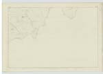
Sheet 27 No. 1 Trace 2
Situation - Garelet Dod - About 3/8 of a Mile N [North] of Ellers Cleugh Rig
Situation - Ellers Cleugh Rig - About ½ Mile West of Brad Moss
Transcribers who have contributed to this page.
Nellie- Moderator, JOANMUIR
Location information for this page.
Linked mapsheets.