OS1/24/47/61


| List of names as written | Various modes of spelling | Authorities for spelling | Situation | Description remarks |
|---|---|---|---|---|
| CHALK RIG EDGE | Chalk Craig Edge Chalk Craig Edge Chalkrig Edge Chalkrig Edge Chalk Rig Edge Chalk Rig Edge |
James Tait Earlshaugh James Watson Tweedhope Foot Johnston's Co. [County] Map Armstrong's Co. [County] Map Mr J. Brown Schoolmaster Revd. [Reverend] A. Todd Tweedsmuir |
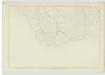
026 | Applied to a hill on the farm of "Earlshaugh" covered with heathy pasture. The Bdy [Boundary] dividing the Counties of Peebles & Dumfries passes over this hill. There is also a Trigl. Stn. [Trigonometrical Station] on the summit of this hill. It is the property of Mr Welsh Errickstane. |
| COR WATER | Cor Water Cor Water Cor Water Cor Water |
James Tait James Watson Johnston's Co. [County] Map Armstrongs Co. [County] Map |
026 | A Stream which rising in "Chalk Rig Edge" flows in a N.W. North Westerly] direction till it joins the River Tweed a little above "Glencraigie" Herds House. |
Continued entries/extra info
[Page] 61Tweedsmuir Parish
Sheet 26 No 11. Trace 2
Situation - Chalk Craig Edge - About 5/8 of a Mile N.E [North East] of Great Hill
Situation - Cor Water - Flows 25 Chains North of Great Hill
Transcribers who have contributed to this page.
Nellie- Moderator, Nora Edwards, JOANMUIR
Location information for this page.
Linked mapsheets.