OS1/24/27/21


| List of names as written | Various modes of spelling | Authorities for spelling | Situation | Description remarks |
|---|---|---|---|---|
| WOOD BRAE | Wood Brae Wood Brae |
W Dalgliesh Thomas Sykes Talla |
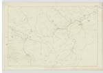
024 | [Situation] In the SW [South West] Corner of Lyne [Part of) A small ridge West of Nickies Knowe on the farms of Talla and Meggethead. The surface of which is Rough Pasture. |
| MEGGET WATER | Megget Water Megget Water |
W Dalgliesh Thomas Sykes Johnston's Co. [County] Map Armstrong's Co. [County] Map |
024 | [Situation] Runs through the central portion of Lyne (part of) A small River which gathers in Talla Moss and flows North East until it empties itself into St Mary's Loch. |
| TALLA MOSS | Talla Moss | described in name Sheets of this plan in Tweedsmuir Ph [Parish] |
Continued entries/extra info
[Page] 21Parish of Megget -- Sheet 24 No 10 Trace 1
Talla Moss
described in Name Sheets of this plan in Tweedsmuir Ph [Parish].
Transcribers who have contributed to this page.
Bizzy- Moderator, JOANMUIR
Location information for this page.
Linked mapsheets.