OS1/24/20/7


| List of names as written | Various modes of spelling | Authorities for spelling | Situation | Description remarks |
|---|---|---|---|---|
| BYREHOPE MOUNT | Byrehope Mount Byerhope Mount Byerhope Mount Byerhope Mount |
A Dunlop Shepherd Hareshaw John Ireland Shepherd Baddinsgill Johnston's Co. [County] Map Armstrong's Co. [County] Map |
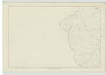
004 | [Situation] In the N. [North] western portion of the parish of Linton A large ridge, the surface of which is Heathy Pasture. This ridge runs north and South, on the south end there is a Trigl. [Trigonometrical] Station called " Wakefield Common" and on its north end there is one called "Wolfcraigs". The property of the Earl of Wemyss, and R. Gordon Esq. |
| BYRE HOPE | Byre Hope Byre Hope |
A. Dunlop Hareshaw John Ireland Baddinsgill |
004 | [Situation] Near the N.E. [North East] side of Byrehope Mount A steep narrow ravine through which runs a stream a tributary of Baddinsgill Burn |
Continued entries/extra info
[Page] 7Parish of Linton -- Sheet IV Plan 4 Trace 1,2,3,4,&, 5,
Transcribers who have contributed to this page.
Bizzy- Moderator, P Wills
Location information for this page.
Linked mapsheets.