OS1/24/14/43


| List of names as written | Various modes of spelling | Authorities for spelling | Situation | Description remarks |
|---|---|---|---|---|
| BLACKHOPEBYRE BURN | Blackhopebyre Burn Blackhopebyre Burn Blackhopebyre Burn Blackhopebyre Burn |
George Little James Anderson John Little Shepherds Johnston's Co [County] map |
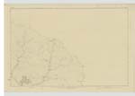
010 | [Situation] Runs S [South] of Blackhopebyre This burn rises about the union of Lamb Law, Windlestraw Law, And Wallet Knowe -- & After running nearly in the Course of a half circle, discharges itself into Glentress Water, near Blackhopebyre. It forms the March or boundary, betwixt the farms of Blakehopebyre & Colquhar. |
| WALLET KNOWE | Wallet Knowe Wallet Knowe |
John Hogg Farmer James Anderson George Little Shepherds |
010 | [Situation] About ¾ of a Mile West from Blackhopebyre A Considerable hilll on the farm of Colquhar having a Trigonometrical Station on its Summit. It is Situated near the Sources of, And bounded by Glentress and Blackhopebyre burns -- As well as Glentress Rig And Windlestraw Law. It consists chiefly of Moss. |
Continued entries/extra info
[page] 43Parish of Inverleithen -- Sheet 10 No 14 -- Traces 2 & 4 & 5
Transcribers who have contributed to this page.
Moira L- Moderator, P Wills
Location information for this page.
Linked mapsheets.