OS1/24/14/28


| List of names as written | Various modes of spelling | Authorities for spelling | Situation | Description remarks |
|---|---|---|---|---|
| GIL BURN | Gill Burn Gill Burn |
John Hogg Farmer Blackhopebyre George Little Shepherd Glentress |
010 | [Situation] About ¾ of A Mile N.E. [North East] from Whitehope Law A small rivulet or Burn which takes its rise from "Gill Well" and running in a southwardly direction falls into "Middle Burn" |
| DRYCLEUGH BURN | Drycleugh Burn Drycleugh Burn |
John Hogg Farmer Blackhopebyre George Little Shepherd Glentress |
010 | [Situation] About ¾ of A Mile North of Blackhopebyre Rig A small Rivulet or Burn which takes its rise upon "East side Hieghts" and running in a westerly direction falls into "Gill Burn; at its source there is a large Cleuch or steep rugged glen which owing to its steepness water soon runs out of - hence the name. |
| EASTSIDE HEIGHTS | Eastside Heights Eastside Heights |
John Hogg Farmer Blackhopebyre George Little Shepherd Glentress |
010 | [Situation] North of the Sole A very large hill the Surface of which is covered with Moss and Heathy Pasture; upon its summit there is a Trigl. [Trigonometrical] Station which stands very near to the County Boundary Called the "Sole". It is the property of John Millar Esqr Liethen Lodge, |
Continued entries/extra info
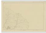
[page] 28Parish of Inverleithen -- Sheet 10 No 10 -- Trace 2
[Note] -- "Gil" A Steep Narrow glen, a Ravine -- Jamieson's Scott [Scottish] Dicty. [Dictionary]
Transcribers who have contributed to this page.
Nora Edwards, Moira L- Moderator, P Wills
Location information for this page.
Linked mapsheets.