OS1/24/2/28


| List of names as written | Various modes of spelling | Authorities for spelling | Situation | Description remarks |
|---|---|---|---|---|
| PYKED STANE | Pyked Stane Pyked Stane Pyked Stane Pyked Stane Pyked Stane Pykes Stone Pykes Stone Pykes Stone |
Robert Ritchie George Sandilands John Graham John Smith New Stat. acct [Statistical Account] Johnston's Co. [County] Map Map of Tweeddale 1775 Companion to Map of Tweeddale 1775 |
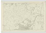
012 | [Situation] North Extremity of Broughton Heights This name applies to a Cairn marking the point where the three Parishes of Broughton, Kirkurd and Stobo Joins. It is situated on the highest point of the Broughton Heights and nearly in the Centre of the Range |
| PYKED STANE HILL | Pyked Stane Hill Pyked Stane Hill Pyked Stane Hill Pyked Stane Hill |
Robert Ritchie George Sandilands John Graham John Smith |
012 | [Situation] Northern Extremity of Broughton Heights A Considerable Eminence forming one of a Range of Hills called Broughton Heights, on the top of which is a Cairn Called the Pyked stane marking the Junction of three Parishes. It commands Very Extensive Views of the surrounding Country. |
Continued entries/extra info
[page] 28Parish of Broughton
Sheet 12 No. 5 -- Trace 1
Transcribers who have contributed to this page.
Moira L- Moderator, P Wills
Location information for this page.
Linked mapsheets.