OS1/23/26/114


| List of names as written | Various modes of spelling | Authorities for spelling | Situation | Description remarks |
|---|---|---|---|---|
| MINISTERS FLAG | Ministers Flag Ministers Flag Ministers Flag |
Robert S. Stevenson Clerk to Thomas Traill Esq. of Holland & Papa Westray James Miller Farmer Backiskeel Thomas Hourston, Farmer Vestness | 075 | A large flat rock, on the west side of Papa Westray 1/8 mile direct west of Nestaben. It derives its name from the fact of the Minister having landed here before a pier was erected on the Island. |
| PAPA SOUND | Papa Sound Papa Sound Papa Sound |
as above Robert S. Stevenson Clerk to Thomas Traill Esq. of Holland James Miller Farmer Backiskeel Thomas Hourston, Farmer Vestness |
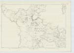
075 | A narrow straight between the islands of Westray and Papa Westray, its average breadth is about 1 1/2 miles by about 4 miles in length |
| ROSS GEO | Ross Geo Ross Geo Ross Geo |
as above Robert S. Stevenson Clerk to Thomas Traill Esq. of Holland James Miller Farmer Backiskeel Thomas Hourston, Farmer Vestness |
075 | A small creek on the west side of the Bay of Millymay 1/4 mile south east of Vestness farm |
Continued entries/extra info
114 Island of Papa Westray Parish of Westray, OrkneyPage signed -
"H. J. Poole"
Transcriber's notes
[According to Jocelyn Rendall in her book "Steering the Stone Ships - The Story of Orkney Kirks and People":-"Whenever Blaw [the Minister who resided in Westray] came over from Westray to take a service at St Boniface, he had to moor his boat at 'the Minister's Flag' and walk two very rough miles along the shore to the kirk, because the laird would not allow him to set foot on his land.]
There are two question marks and arrows near the word "straight" in the description of "Papa Sound".
Transcribers who have contributed to this page.
Kugi
Location information for this page.
Linked mapsheets.