OS1/23/7/41


| List of names as written | Various modes of spelling | Authorities for spelling | Situation | Description remarks |
|---|---|---|---|---|
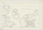
| FLOTTA [island] | Flotta Flotta Flotta Flotta Flotta Flotta Flotta Flota Flota Flota Flota Flota Flota Flota Flotay |
Andrew Gold Esq Grainbank John Ross Farmer Bow James Barnet, Pan Stat a/c of Scotland Peaces Orkney Almanac Oliver & Boyd's Edinburgh Almanac Handbook to the Orkneys Parrys Orkney Islands A.D. 1805 Philips County Atlas Imp. Gazetteer Ad. Chart Johnstons Map of Orkney North Sea Pilot Robertson's Gaelic Top of Scotland Parrys Orkney Islands A.D. 1805 |
119 | One of the inhabited group of the southern isles of Orkney, bounded on the south by the Pentland Firth on the west by Longhope, on the north by Scapa Flow, and on the east by Hoxa Sound. The island is about two miles wide and varying from 1/4 to 3 miles in length. About one half of the island is under cultivation and the remainder is under moss & heather. the whole of the island is low and the soil comparatively good. It is ecclesiastically united with the parish of Walls, but has a neat & comfortable Mission church of its own with a resident Ordained minister. There is also a good public School and Post Office and an excellent harbour called Pan Hope deriving itss name (tradition says) from a salt pan at one time used here for manufacturing salt out of sea water. There are no antiquities of any kind known on the island. The Earl of Zetland is sole proprietor. |
Transcribers who have contributed to this page.
MoragSinclair
Location information for this page.
Linked mapsheets.