OS1/23/3/115


| List of names as written | Various modes of spelling | Authorities for spelling | Situation | Description remarks |
|---|---|---|---|---|
| COPINSAY SKERRY | Copinshay Skerry Copinshay Skerry Copinshay Skerry Copinshay Skerry Copinsay Copinshay |
Mr James Foubister Farmer Newbanks Mr Andrew Gold Factor Kirkwall Mr Andrew Kirkniss Mason Newbanks Handbook to the Orkney Islands Johnston's Map of the Orkneys Orkney Map. Statl. [Statistical] Acct. [Account] |
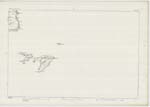
116 | A tidal rock situated in the above parish and immediately north of Copinshay Farm House. |
| OUTER DEEP | Outer Deep Outer Deep Outer Deep |
Mr James Foubister Farmer Newbanks Mr Andrew Kirkniss Mason Newbanks Mr Andrew Gold Factor Kirkwall | 116 | A small bay situated on the north side of Ilse Rough and a short distance north of Sows Skerry |
| SOW SKERRY | Sow Skerry Sow Skerry Sow Skerry |
Mr James Foubister Farmer Newbanks Mr Andrew Kirkniss Mason Newbanks Mr Andrew Gold Factor Kirkwall | 116 | A tidal rock situated on the south side of Isle Rough and about the centre of the channel formming a small peninsula in the above Parish |
Continued entries/extra info
Parish of Deerness OrkneySigned Kenneth Campbell C/A
Transcribers who have contributed to this page.
Quakecity
Location information for this page.
Linked mapsheets.