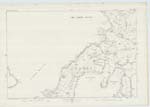
OS1/23/2/130
| List of names as written | Various modes of spelling | Authorities for spelling | Situation | Description remarks |
|---|---|---|---|---|
| LANGIE GEO | Langie Geo Langie Geo Langie Geo |
Rev. M. Fisher of Cross & Burness James Muir Braeswick James Muir Scarrigarth | 081 | A large stony creek situated three eighths of a mile east of Warsetter and one quarter south of "Linday Geo". |
| MOO GEO | Moo Geo | Rev. M. Fisher of Cross & Burness James Muir Braeswick James Muir Scarrigarth | 081 | A large stony Geo or creek situated three quarters of a mile southwest of "Bacaskail" and one quarter east of "Warsetter". |
| SANDAY SOUND | Sanday Sound | Rev. M. Fisher of Cross & Burness James Muir Braeswick James Muir Scarrigarth | 081 | A large navigable strait washing the greater part of the south coast of the Island of Sanday. "Sanday Sound" is between Tres Ness and Papa Stronsay" - North Sea Pilot. Its average width is from three to four miles. There is a few large and good anchoring Bays penetrating north on the Sanday shore, from this sound, namely those of "Bacaskail" "Stove", and "Kettletoft." The steam ship "Orcadia" anchors in the latter four times a week. |
Transcribers who have contributed to this page.
MoragSinclair
Location information for this page.
Linked mapsheets.


