OS1/23/2/117


| List of names as written | Various modes of spelling | Authorities for spelling | Situation | Description remarks |
|---|---|---|---|---|
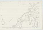
| KETTLETOFT BAY | Kettletoft Bay | Rev. John Dangerfield Minister of Lady Parish W. Miller Postmaster Castlehill John M. Slater Skelbister |
081 | A large bay penetrating inland from Sanday Firth, in a northerly direction. It is bounded on the east by "Els Ness" and on the west by Bea Ness. Its length is about three quarters of a mile and its width about half a mile. There is about half a mile of it completely dry at low water. It is a safe anchorage for vessels with easterly or westerly Gales. |
| OUSE POINT | Ouse Point | Rev. John Dangerfield Minister of Lady Parish W. Miller Postmaster Castlehill John M. Slater Skelbister |
081 | A narrow peninsula penetrating in an easterly direction to the head of the Ouse. It is nearly joined by another promontory penetrating north from Elsness farm. The Ouse cuts the connection. |
| THE OUSE | The Ouse The Ouse The Ouse |
Rev. John Dangerfield Minister of Lady Parish W. Miller Postmaster Castlehill John M. Slater Skelbister |
081 | A small low water channel. It first issues out of a small fresh water loch forty yards east of "Little Overthewater" and flows south for about eighty yards, it then flows south east entering the "Little Sea" one eighth of a mile west of Bridgend. It continues this course for two hundred yards' further, when it enters a deep salt water pool. It then changes & flows south. From the above mentioned pool southward it is known as the "Ouse". |
Transcribers who have contributed to this page.
MoragSinclair
Location information for this page.
Linked mapsheets.