OS1/11/61/25


| List of names as written | Various modes of spelling | Authorities for spelling | Situation | Description remarks |
|---|---|---|---|---|
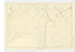
| LADYSIDE HEIGHT | Ladyside Height | Walter Sword Ladyside J Morrison Dewar Gill Toll Bar |
022 | [Situation] Stow. A long ridge or hill extending from "The Sole" to "Rawburn Head". The Ph. [Parish] Boundary between Borthwick and Stow runs along the Summit of it. |
| SOLE BURN | Sole Burn | Walter Sword Ladyside J Morrison Dewar Gill Toll Bar |
022 | [Situation] Stow. A mountain Stream rising near the top of "The Sole" and flowing in a north easterly direction till it joins "Shiel Burn". |
| SHEIL BURN | Sheil Burn | Walter Sword Ladyside J Morrison Dewar Gill Toll Bar |
022 | [Situation] Stow. A small mountain Stream rising near the top of "The Sole" and flowing in a north eastward direction between "Weather Law" and "Rawburn Head" and falling into "Lugate Water" at "Over Shiel" |
| WEATHER LAW | Weather Law | Walter Sword Ladyside J Morrison Dewar Gill Toll Bar |
022 | [Situation] Stow. Supplied on adjoining Trace |
| VAULAND BURN | Vauland Burn | Walter Sword Ladyside J Morrison Dewar Gill Toll Bar |
022 | [Situation] Stow. Supplied on adjoining Trace |
| THE SOLE | The Sole | Walter Sword Ladyside J Morrison Dewar Gill Toll Bar |
022 | [Situation] Stow. Supplied on adjoining Trace |
Continued entries/extra info
[Page] 25Names Collected by J McDiarmid c.a. [Civilian Assistant]
Plan 22 D Trace 4
Transcriber's notes
Improvised form on sheet of plain paper.Inconsistency in spelling "Sheil" and "Shiel".
Transcribers who have contributed to this page.
JCB
Location information for this page.