OS1/11/61/17


| List of names as written | Various modes of spelling | Authorities for spelling | Situation | Description remarks |
|---|---|---|---|---|
| LADYSIDE HEIGHT | Ladyside Height Ladyside Height |
Walter Sword James Morrison |
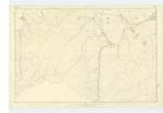
022 | [Situation] About 13/8 S. [South] east from Dewar A Hill of a Ridge liKe Shape extending from the Sole to Rawburn Head, the boundary line betwixt the parish of Heriot and Stow Runs along its Summit. |
| THE SOLE | The Sole The Sole The Sole |
Walter Sword J. Morrison Co. [County] Map. 1847 |
022 | [Situation] About 13/4 S. E. [South East] from Dewar For Descriptive RemarKs, See Name BooK. Plan 25 A. |
| SOLE BURN | Sole Burn Sole Burn |
Walter Sword James Morrison |
022 | [Situation] Nearly 13/4 Mile S. E. [South East] by S. [South] from Dewar A Stream or burn having its Rise on the Sole, and running in a N. [North] easterly direction to its junction with Shiel Burn |
Continued entries/extra info
Parish of Stow [Page] 17Transcribers who have contributed to this page.
Molly Miller
Location information for this page.