OS1/11/60/9


| List of names as written | Various modes of spelling | Authorities for spelling | Situation | Description remarks |
|---|---|---|---|---|
| CLEAVE RIG | Cleave Rig Cleave Rig Cleavy Rig |
J S. Gilchrist Robert Abernethy Co,, [County] Map |
022 | A hill of a ridge like shape on the West side of Blackhope Scar its surface consists of heathy pasture, |
| LONG CLEAVE BURN | Long Cleave Burn Long Cleave Burn The Cleaves |
Mr. Gilchrist Robert Abernethy Co,, [County] Map |
022 | A small stream having its rise on Blackhope Scar, an running in a Westerly direction past Cleave Rig, |
| LONG EDGE | Long Edge Long Edge Long Edge Long Edge |
JS Gilchrist Mr. Abernethy Co,, [County] Map Map of Roads |
022 | A hill of a ridge like shape on the southern extremity of the parish of Temple. |
Continued entries/extra info
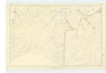
[page] 9 Parish of TempleLong Cleave Burn -- On the West side of Blackhope,
Long Edge -- about 3/4 of a mile S.E. by E. [South East by East] from Bowbeat.
Cleave Rig -- about 3/4 mile E.S.E. [Est South Est] from Bowbeat
[Numbers in margin] -- Cleave Rig [and] Long Cleave Burn -- 23 -- Long Edge -- 24
Transcribers who have contributed to this page.
ADobie
Location information for this page.