OS1/11/60/22


| List of names as written | Various modes of spelling | Authorities for spelling | Situation | Description remarks |
|---|---|---|---|---|
| BOWBEAT BURN | Bowbeat Burn | James Gilchrist Gladhouse Mr Prenderleith Moorfoot |
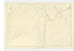
022 | [Situation] Temple Ph [Parish]. A Small Stream which takes its rise in Bowbeat Hill and runs in an N.E [North East] direction till it joins the Gladhouse B [Burn] |
| BOWBEAT HILL | Bowbeat Hill | James Gilchrist Gladhouse Mr Prenderleith Moorfoot |
022 | [Situation] Temple Parish. A hill of considerable size west of Corby Bank forming a part of the boun [boundary] between the Counties of Peebles & Edinbu [Edinburgh] on its Summit Stands a Trigl ^ [Trigonometrical Station] calld [called] Bowbeat Hill |
| EMLY BANK | Emly Bank | James Gilchrist Gladhouse Mr Prenderleith Moorfoot |
022 | [Situation] Temple Parish. A long ridge of a hill on the Sou [South] Side of Bowbeat Burn along the su [summit ?] of which runs the boundary of the Counties of Peebles & Edinburgh |
| GLADHOUSE WATER | Gladhouse Burn | James Gilchrist Gladhouse Mr Prenderleith Moorfoot |
022 | [Situation] Temple Parish. A considerable Stream which is formed by the junction of Bowbeat Burn the Cle and other tributaries to where it takes the name S. [south] Esk a short distance South of Moorfoot farmh [farmhouse ?] |
Transcriber's notes
Some words of Description are partly lost in tight binding of right margin.Note discrepancy between prepopulated Name "Gladhouse Water" and Name as appears on page "Gladhouse Burn".
Continued entries/extra info
[Page] 22Names Collected by John Early ca [Civilian Assistant]
Plan 22C T [Trace] 1
Transcribers who have contributed to this page.
JCB
Location information for this page.