OS1/11/47/39


| List of names as written | Various modes of spelling | Authorities for spelling | Situation | Description remarks |
|---|---|---|---|---|
| FONT STONE | Font Stone | Rev. S. Moncrieff Penicuick Manse Stat. [Statistical] account of Penicuick p 420 |
017 | A granite stone 3 ft. [feet] by 2 ft. [feet] 10 and 16 inches in thickness with a rectangular basin or hollow in the centre 1 ft. [foot] by 8 inches, and 9 in depth said to be the socket in which a cross was once inserted upon the side of the stone two hollows, appear which tradition states to have been worn by the kneeling of passing worshippers. - the stone stands upon the summit of a heathy hill called Monk's Rig and immediately alongside an ancient path called the Monk's Road, which once connected Tweeddale with the district north of the "Pentlands". |
Continued entries/extra info
[Page] 39[Parish of Penicuick]
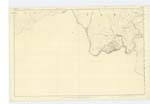
Plan 17B Trace 2
2nd. Corpl. [Corporal] Mechan RSM [Royal Sappers & Miners] 1st. Exer. [Examiner]
[signed] John Mechan
2nd. Corpl. [Corporal] RSM [Royal Sappers & Miners] 21.1.52
Transcribers who have contributed to this page.
ADobie
Location information for this page.
Linked mapsheets.