OS1/11/47/10


| List of names as written | Various modes of spelling | Authorities for spelling | Situation | Description remarks |
|---|---|---|---|---|
| MONKS RIG | MonK's Rig MonK's Rig MonK's Rig |
John Laing UnthanK David Alexander EsK Cottage Co. [County] Map |
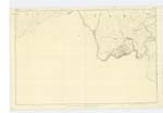
017 | [Situation] About 1½ Miles N. [North] from Newhall House A tolerably Sized hill of a Ridge liKe form Situated on the farm of Westside And forming part of the Pentland Range |
| FONT STONE | Font Stone -. Font Stone -. |
Revd. [Reverend] S. Moncreiff PenicuiK Manse Statistical Acct. [Account] of PenicuiK P [Page] 420 vol. [volume] 10. |
017 | [Situation] About 1½ Mile N. [North] from Newhall House A granite Stone 3 ft. [feet] by 2 ft. [feet] 10 And 18 inches in thicKness. having a Rectangular basin or hollow in the centre 1ft. [foot] by 8 inches and 9 inches in depth. Said to be the SocKet in which a cross was once inserted. on one Side of the Stone two hollows appear which tradition States to have been worn by the Kneeling of passing worshippers. It stands on the Summit of MonK's Rig, and within a few yards of An Ancient Pathway Called "MonK's Road" which once Connected Tweeddale with the district North of PentlandS |
| MONKS ROAD | Monks Road Monks Road |
Revd. [Reverend] S Moncreiff David Alexander |
017 | Leading N. [North] from Scroggy Hill |
Continued entries/extra info
[Page] 10 Parish of PenicuiKTranscribers who have contributed to this page.
Molly Miller
Location information for this page.
Linked mapsheets.