OS1/11/10/11


| List of names as written | Various modes of spelling | Authorities for spelling | Situation | Description remarks |
|---|---|---|---|---|
| STANDING STONES [Newbridgel | Standing Stones Standing Stones Standing Stones |
Rev [Reverend] Mr Tait Stat. Acct. [Statistical Account] 1845 County map |
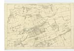
005 | [Situation] About 1 1/2 mile N.W. by N. [North West by North] from Ratho. Four large granite Stones Standing upon their ends embedded in the earth They are about 4 feet each above the earth and about 2 feet in circumference. These stones are said to be erected to commemorate a battle which was fought about the year 995. Three of those standing stones form a triangle and another stands isolated at a distance there is a tumulus at this place which tradition say contains the remains of those Killed in the battle The stones are said to be the tombstones of the chiefs who fell or monuments to Commemorate the battle There were several Stone coffins found near this place from time to time. "We are informed by Buchanan & other historians that there was a bloody battle fought near this place on the banks of the Almond in the year 995 between Kennethus natural brother and Commander of the forces of Malcolm ll [Second] King of Scotland and Constantine the usurper of that crown wherein both the generals were Killed. About 2 miles higher up the river, on the Bathgate road is the circular mound of earth formerly mentioned. The whole intermediate space, from the human bones dug up and graves of unpolished stones discovered below the surface seems to have been the scene of many battles. This is rendered probable from the importance of the situation as the first opening after the Carse of Stirling from the north and West Highlands to the richer places of Scotland" Sinclair's Stat. Acct. [Statistical Account] vol [volume] 10 P. [Page] 75. |
Continued entries/extra info
[Page] 11Parish of Kirkliston
Transcribers who have contributed to this page.
JCB
Location information for this page.
Linked mapsheets.