OS1/11/1/6


| List of names as written | Various modes of spelling | Authorities for spelling | Situation | Description remarks |
|---|---|---|---|---|
| RIVER ALMOND | River Almond The Almond Almond Water Amon Cramond River River Almond River Almond |
Stat. Acct. [Statistical Account] 1845 Fullarton's Gazetteer Map attached to Stat. Acct [Statistical Account] of Co. [County] Edinburgh Thomson Atlas Railway maps of Scotland W. L.Colvin. W. Clarke |
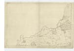
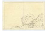
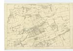
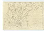
001 ; 004 ; 005 ; 010 | [Situation] The Western boundy [boundary] of the Co. [County] of Edinburgh. A considerable river which rises in the muir of Shotts about a mile S.E. [South East] of the Kirk of Shotts near the Cant Hills inthe County of Lanark and running in an easterly direction in a line nearly parallel with the post road from Glasgow to Edinburgh by Whitburn which it crosses at Blackburn and recrosses again near Mid Calder. From a little beyond Mid Calder it flows in a north easterly direction and forms the boundary between the Counties of Linlithgow and Edinburgh passing Ammondel, Bliston, Kirkliston, Carlourie and Craigiehall and falls into the Firth of Forth at the village of Cramond where it forms a small estuary navigable for boats for a short distance. The Edinburgh & Glasgow Union Canal is carried across this river near Clifton Hall in the parish of KirKliston by a well constructed aquaduct. The Edinburgh and Glasgow railway is also carried across it lower down the river near KirKliston by an immense viaduct of 43 arches of 50 feet span each and varying from 60 to 85 feet in height. Its principal tributary is the Broxburn which is wholly a Linlithgowshire stream and flows into it from the west a little above Kirkliston. |
Continued entries/extra info
[Page] 6Parish of Cramond
Form 136 Page
64 - River Almond
[note]
not in forms 136
Yes it is - lower portions of p. [page] 64.
Transcribers who have contributed to this page.
Bizzy- Moderator, M.Ogilvie
Location information for this page.