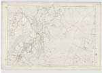
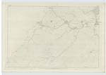
OS1/21/23/33


| List of names as written | Various modes of spelling | Authorities for spelling | Situation | Description remarks |
|---|---|---|---|---|
| GLENBUCK T.P. | Glenbuck T.P. [Turnpike] Glenbuck T.P. [Turnpike] Glenbuck T.P. [Turnpike] |
Thos. [Thomas] R Scott Esq Rev John Jamieson Mr Jas. [James] Scott |
041 | Small turnpike. The house is in Muirkirk Ph [Parish] Ayrshire - full rates leviable |
| HASHY BURN | Hashy Burn Hashy Burn Hashy Burn |
Thos. [Thomas] R Scott Esq Rev John Jamieson Mr Jas. [James] Scott |
038 | A small stream which rises on the boundary between Roberton & Douglas Phs [Parishes] and falls into Milking Burn after a short course in the latter |
| LIMMER HILL | Limmer Hill Limmer Hill Limmer Hill |
Thos [Thomas] R. Scott Esq Mr John Jamieson Mr Jas. [James] Scott |
038 | A high R.P. [Rough Pasture] hill Gradual slope on all sides. Origin of name unknown |
| MILKING BURN | Milking Burn Milking Burn Milking Burn |
Thos. [Thomas] R Scott Esq Rev John Jamieson Mr Jas. [James] Scott |
038 | A stream which rises about half a mile within Douglas Ph [Parish] and flows into the Ph [Parish] of Roberton. |
| MOUNTSTUART | Mountstuart Mountstuart Mountstuart Mount Stewart Mountstewart |
Thos. [Thomas] R Scott Esq Rev John Jamieson Mr Jas. [James] Scott Forrest's Map Johnston's Map |
038.07 | Farmsteading in good repair. There is no hill in the locality named Mount Stuart. |
| ROBERT LAW | Robert Law Robert Law Robert Law |
Thos [Thomas] R. Scott Esq Rev John Jamieson Mr Jas. [James] Scott |
038 | Conspicuous RP [Rough Pasture] hill - steep on the N. [North] side |
Continued entries/extra info
33 [right corner of header]Ph [Parish] of Douglas [in header]
Transcribers who have contributed to this page.
JCB
Location information for this page.