OS1/21/18/295


| List of names as written | Various modes of spelling | Authorities for spelling | Situation | Description remarks |
|---|---|---|---|---|
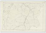
| DURISDEER HILL | Durisdeer Hill, Wall Height. | James Hope, Thomas Johnstone, John Wilson Esqr., Co. Map (Forest's), O.S. Plan of Dumfriesshire. | 053 | A large prominent hill over which a stone wall runs which forms the boundary between the Cos. of Dumfries and Lanark. On the Ordnance Plan of Dumfries this hill is called Wall Height; I can not get authorities for the latter name in Crawford Parish. |
| KIRK GRAIN | Kirk Grain | James Hope, Thomas Johnstone, John Wilson Esqr. | 053 | A small burn rising on the side of Little Scaw'd Law near the head of Potrail Water of which it is a tributary. |
| POTRAIL SIKE | Potrail Sike | James Hope, Thomas Johnstone, John Wilson Esqr. | 053 | A small burn rising near the source and forming one of the tributaries of Potrail Water; there is another burn called "Potrail Sike" one is one the farm of Kirkhope and the other Troloss. Both are well known by the authorities quoted. |
Transcribers who have contributed to this page.
Brenda Pollock
Location information for this page.
Linked mapsheets.