OS1/21/17/49


| List of names as written | Various modes of spelling | Authorities for spelling | Situation | Description remarks |
|---|---|---|---|---|
| BROWN RIG | Brown Rig Brownrig |
T.R. Scott. Esq: Factor Rev[Reverend] William Gouldie. Minister. Mr Robb. Schoolmaster. Mr J Watson. Merchant Forrest's County Map dated 1816 Johnston's County Map |
046.05 | A small Rough Pasture Hill the property of the Earl of Home |
| COAL BURN | Coal Burn | T.R. Scott. Esq: Factor Rev[Reverend] William Gouldie. Minister. Mr Robb. Schoolmaster. Mr J Watson. Merchant | 046.05 | A small stream which rises on Brown Rig and flowing in a S.W. direction joins Duneaton Water after a course of about 35 chains |
| COMMON HILL | Common Hill Common |
T.R. Scott. Esq: Factor Rev[Reverend] William Gouldie. Minister. Mr Robb. Schoolmaster. Mr J Watson. Merchant Johnston's County Map Forrest's County Map dated 1816 |
046.01 | A large Rough Pasture Hill the property of the Earl of Home |
| DALEBANK | Dalebank | T.R. Scott. Esq: Factor Rev[Reverend] William Gouldie. Minister. Mr Robb. Schoolmaster. Mr J Watson. Merchant | 046.01 | A newly erected cothouse. one storey slated and in good repair with a small garden attached it is the property of the Earl of Home |
| GREEN BURN | Green Burn | T.R. Scott. Esq: Factor Rev[Reverend] William Gouldie. Minister. Mr Robb. Schoolmaster. Mr J Watson. Merchant | 045 | A small stream which after flowing in a N. direction for 15 chains joins Duneaton Water. |
| KNEES HILL | Knees Hill Kneeshill |
T.R. Scott. Esq: Factor Rev[Reverend] William Gouldie. Minister. Mr Robb. Schoolmaster. Mr J Watson. Merchant Forrest's County Map dated 1816 Johnston's County Map |
045 | A medium sized Rough Pasture Hill the property of the Earl of Home |
| STONEHILL BANK | Stonehill Bank Bank |
T.R. Scott. Esq: Factor Rev[Reverend] William Gouldie. Minister. Mr Robb. Schoolmaster. Mr J Watson. Merchant Forrest's County Map dated 1816 |
A small but very steep Rough Pasture Hill the property of the Earl of Home. |
Continued entries/extra info
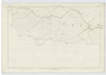
[Situation of Common Hill] Near the Douglas Boundy[Boundary] and west of Glespin.[Situation of Knees Hill] West of Common Hill
[Situation of Brown Rig] South of Common Hill
[Situation of Stonehill Bank] South East of Brown Rig
[Situation of Coal Burn] West of Brown Rig
[Situation of Dalebank] East of Common Hill
[Situation of Green Burn] West of Greenburn
Transcriber's notes
The authorities for the spelling 'Common' are Johnston's County Map and Forrest's County Map. The other authorities are for 'Common Hill'The authority for the spelling 'Kneeshill' is Johnston's County Map. The other authorities are for 'Knees Hill'
The authority for the spelling 'Brownrig' is Johnston's County Map. The other authorities are for 'Brown Rig'
The authority for the spelling 'Bank' is Forrest's County Map. The other authorities are for 'Stonehill Bank'
No sheet number is given for Stonehill Bank
entry for Alder Burn is crossed out - see pages 51 and 59
Transcribers who have contributed to this page.
douglas
Location information for this page.
Linked mapsheets.