OS1/21/6/16


| List of names as written | Various modes of spelling | Authorities for spelling | Situation | Description remarks |
|---|---|---|---|---|
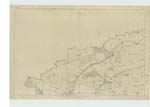
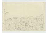
| WALL OF ANTONINUS PIUS (Remains of) [in Cadder parish] | Site of Fosse or ditch of Roman Wall Site of Fosse or ditch of Roman Wall Site of Fosse or ditch of Roman Wall Site of Fosse or ditch of Roman Wall Site of Fosse or ditch of Roman Wall |
Revd [Reverend]J.Park, Cadder Manse James Russell, Steward of Cawder Estate Thomas Scott, Farmer, Easter Cawder Robert Craig, Farmer, Buchley John Scott, Farmer, Balmuildy John Graham, Farmer, Somerston (Stirlingshire) |
001; 002 | "This great military work consisted, in the first place, of an immense fosse or ditch__ averaging about 40 feet in width by some 20 in depth__ which extended over hill & dale in one unbroken line from sea to sea. Behind the ditch, on its southern side, & within a few feet of its edge, was raised a rampart of intermingled stone & earth, strengthened by sods of turf; which measured it is supposed, about 20 feet in height & 24 in thickness at the base. This rampart or agger was surmounted by a parapet behind which ran a level platform for the accomodation of its defenders. To the southward of the whole was situated the Military Way. Along the whole line from West Kilpatrick to Carriden, there were established, it is believed, nineteen principal Stations or Forts. The mean distance between each may be stated at rather more than two English miles. Along these intervals were placed many smaller Castella or Watch Towers, of which only some two or three could be discovered in 1755" Caledonia Romana The course of the Fosse or Ditch of the Roman wall, where it enters the parish from Kirkintilloch, may be seen by a hollow appearance in the ground, varying in width & depth as shown on the Examination Traces. The remains of the Wall are few & very much defaced. The Forth & Clyde Canal crosses it twice in the parish__ at Glasgow Bridge & Cadder. From the field where it enters the parish (I.8 Traces 3 & 6) to Glasgow Bridge, a foundation resembling a causewayed road was found between 20 & 40 feet from the Fosse. A similar foundation has been found nearly the whole way through the parish. At Glasgow Bridge a Roman Lamp was found at the place marked. In a strip of plantation (I.8 Trace 4) there are some slight remains of the Wall to be seen, but much defaced. Between this & the Farm of Crofthead a Roman Well was (covered) about 20 years ago. From the Canal at the end of the Glebe to the remains of the Watch Tower, the site is not known. This part, & the portion between Cawder Wood & the west end of the slight portion of the Wall that still exists, fronting the Watch Tower, are, with the exception of Balmuildy, the only places that the site is unknown. Where it passes Cadder Wood, there are the best remains of the Rampart or Wall in the parish. The Fosse is also deepest on one side __ south. (See Caledonia Romana _ 311.315) At this place (I-10-3 & I.11-1) the Military Way is a good distance from the Fosse, & the ground between is naturally wet. In two places on this Farm the Ditch forms horseponds at the ends of fields. At Balmuildy the traces of the Fosse are lost in the field where the Fort is said to have stood. In this field a track is found resembling the soil of the Fosse in the adjacent field, when turned up by the plough. On the other side of the River Kelvin (in Stirlingshire) the point where it crosses _ going direct to Somerston Farm Steading, is known by the peculiarity of the soil. It does not, however, agree with the track in the field at Balmuildy |
Continued entries/extra info
[Page] 16Lanarkshire Cadder Parish
Remains of the Wall of Antonius Pius constructed by Lollius Urbicus AD 140 Roman Legions II. VI. and XX. (all in Block Roman Capitals) [ J. B. Capt A.R.]
(See over page)
Transcribers who have contributed to this page.
MarionQuinn
Location information for this page.