OS1/20/7/4


| List of names as written | Various modes of spelling | Authorities for spelling | Situation | Description remarks |
|---|---|---|---|---|
| BLACK CRAIG | Black Craig Black Craig Black Craig |
Andrew Murdoch James Sloan Ainslies map |
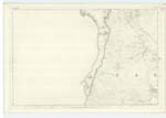
004 | [Situation] About 1 1/2 miles N.W. by W. [North West by West] of Woodhead Lead Mines A large hill on the farm of Lamloch, its surface is rocky pasture. On it is a Trigl.[Trigonometrical] Station called by Trigl.[Trigonometrical] Party "Lamloch Hill". It is a conspicuous part of an irregular range. |
| BLACKCRAIG (Ruins of) | Blackcraig (in ruins) Blackcraig (in ruins) |
Andrew Murdoch Alexander Howetson James Sloan |
004 | [Situation] About 2 1/8 miles NW. [North West] of Woodhead Lead Mines. The ruins of an old house which formerly had a farm of land attached but is long since annexed to the farm of Lamloch. it is situated a Short distance N.[North] East of a hill called Blackcraig hence the name. |
| CULLENDOCH HILL | Cullendoch Hill | Plan 4 A. | 004 | [Situation] About 2 5/8 miles NW by N. [North West by North] of Woodhead Lead Mines For Description see Name List for Plan 4 A. |
Continued entries/extra info
[Page] 4Parish of Carsphairn
Form 136 Page 31 Black Craig
32 Blackcraig (ruins of)
Cullendoch Hill - "See etymology of name in Name List for Plan 4A
Transcribers who have contributed to this page.
Chr1smac -Moderator, Gerald Cummins
Location information for this page.
Linked mapsheets.