OS1/20/7/15


| List of names as written | Various modes of spelling | Authorities for spelling | Situation | Description remarks |
|---|---|---|---|---|
| POLCORROCH BURN | Polcorroch Burn Polcorroch Burn Pollcorroch Burn |
James Weir James Sloan Charles Wilson |
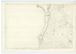
004 | [Situation] Running N.E. [North East] from the north side of KnocKower thence N.E [North East] to it its junction with Green Burn A small stream having its rise on KnocKower and running in a North Easterly direction to its confluence with Green Burn. |
| KNOCKOWER | Knockower Knockower Knockour |
Charles Wilson James Weir Ainslies Map |
004 | [Situation] 3/8 miles NW by W.[North West by West] of Woodhead Lead Mines A tolerably sized hill on the farm of Woodhead, its surface is rocky heathy pasture land. |
| GARRYHORN BURN | Garryhorn Burn Garryhorn Burn Garryhorn Burn Garryhorn Burn |
James Weir James Sloan Charles Wilson Ainslies Map |
004 | [Situation] Running E.[East] passing at the S.[South] side of Woodhead Lead Mines A considerable stream having its rise on the farm of Garryhorn and running in an Easterly direction to its conflux with the "Water of Deugh" |
Continued entries/extra info
[Page] 15Parish of Carsphairn
Form 136 Page 45 Polcorroch Burn
49 Knockower
45 Garryhorn Burn
Transcribers who have contributed to this page.
Chr1smac -Moderator, Gerald Cummins
Location information for this page.
Linked mapsheets.