OS1/20/50/10


| List of names as written | Various modes of spelling | Authorities for spelling | Situation | Description remarks |
|---|---|---|---|---|
| BROCKLOCH HILL | BrocKloch Hill BrocKloch Hill BrocKloch |
William Folds John Wilson Ainslies Map |
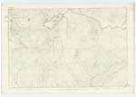
022 | [Situation] About 1/2 Mile South of Lilies Loch A Considerable hill on the farm of BrocKloch (now blended [with] the farm of Craignell) hence the name the Surface of [which] is rocKy heathy pasture, On it is a Trigl. [Trigonometrical] Station Called by Trigl. [Trigonometrical] Party "[BrocKlock]" |
| PULRAN BURN | Pulran Burn Pulran Burn Pulran Burn Pulran Burn |
William Folds John Wilson William Candlish BanKer New Galloway Ainslies Map |
022 | [Situation] Running in a N. [North] Easterly direction from Lilies Loch A Considerable Stream or Burn Running out of Lilies Loch in an Easterly direction [through] the farm of of Craignell, to its influx with the BlacK Water of [Dee] |
| OLD EDINBURGH ROAD | Old Edinburgh Road Old Edinburgh Road |
William Folds John Murray |
022 | [Situation] Passing west Side of Strife Rig & CroSSing Pulran Burn About 11 Chains E N E. [East North East] of Lilies Loch This name applies to the tracK of an old Road leading in an [Easterly] direction from Newtownstewart to Edinburgh - The Deils DicKe, [Runs] alongside this Road (it forms in Some [places] its boundary) Near its approach to the "Black Water of Dee" from "Tolnotrie" |
Continued entries/extra info
[Page] 10 Parish of MinnigaffForm 136
Page 29 -- Brockloch Hill
28 -- Pulran Burn
27-- Old Edinburgh Road
Transcribers who have contributed to this page.
Chr1smac -Moderator, Molly Miller
Location information for this page.
Linked mapsheets.