OS1/20/5/30


| List of names as written | Various modes of spelling | Authorities for spelling | Situation | Description remarks |
|---|---|---|---|---|
| MID RIG | Mid Rig Mid Rig Mid Rig |
James Sloan James Ferguson Ainslies Map 1820 |
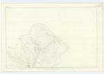
003 | [Situation] About 1 1/2 miles W.S.W.[West South West] of Lorg A tolerably sized hill on the farm of Upper Holm of Dalquhairn its surface is rough and rocky pasture land. |
| SPOUT BURN | Spout Burn Spout Burn |
James Sloan James Ferguson |
003 | [Situation] Running S. [South] to Holm Burn near the W [West] Side of Upper Holm of Dalquhairn A small stream having its rise on the farm of Upper Holm of Dalquhairn, and running in a Southerly direction to its Confluence with Holm Burn, In its Course it falls over a precipitous rock where it is called the Spout, hence the name to the Burn. |
| THE SPOUT | The Spout The Spout |
James Sloan James Ferguson |
003 | [Situation] 1 1/8 miles west of Lorg. (farm house) A waterfall in Spout Burn which is about 30 feet high where the water falls over precipitous rocks. This water- fall gave name to the burn |
Continued entries/extra info
[Page] 30Parish of Carsphairn
Form 136
Page 67 Mid Rig
69 Spout Burn
Transcribers who have contributed to this page.
Chr1smac -Moderator, Gerald Cummins
Location information for this page.
Linked mapsheets.