OS1/20/4/16


| List of names as written | Various modes of spelling | Authorities for spelling | Situation | Description remarks |
|---|---|---|---|---|
| SWARE BRAE | Swere Brae Swere Brae |
Thomas Stewart James Sloan |
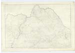
002 | [Situation] About 5/8 Mile N.W. [North West] of Clennoch A small hill on the farms of Moor and Clennoch. its Surface consists of rocky pasture. |
| UPPER HILL | Upper Hill Upper Hill |
A Shaw John Wilson |
002 | [Situation] About 1¼ Miles W by N. [West by North] of Clennoch A considerable Eminence on the N. [North] East side of Waterhead Hill, its surface is rocky pasture. |
| WATERHEAD HILL | Waterhead Hill Waterhead Hill |
John Wilson John Shaw |
002 | [Situation] About 1½ Miles W. [West] of Clennoch A large hill on the farm of Waterhead (hence the name) on it are several Eminences having separate names. On one of which called Nether Hill is a Trigl. [Trigonometrical] Station called by Trigl. [Trigonometrical] Party "Waterhead". This Hill forms part of a range with "Swere Brae" &c. |
Continued entries/extra info
[Page] 16Parish of Carsphairn
Form 136 Page
49 Swere Brae
45 Upper Hill
46 Waterhead Hill
Sware, The most level spot between two hills, The declination of a hill near its summit.
Transcribers who have contributed to this page.
DANIALSAN, Gerald Cummins
Location information for this page.
Linked mapsheets.