OS1/20/37/15


| List of names as written | Various modes of spelling | Authorities for spelling | Situation | Description remarks |
|---|---|---|---|---|
| ISLE RIG | Rough Rig Rough Rig Isle Rig Isle Rig |
James Dungarven John Popple James Foulds Map of Property |
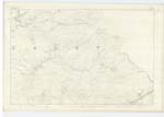
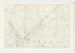
016 | [Situation] About 1 mile E. [East] by South of Lochinvar. A Small hill of a ledge like shape on the farm of Duchraw the surface of which is chiefly heathy pasture. It lies a little S. [South] of Regland Burn which during floods flows round it forming an Island, hence the name. |
| REGLAND BURN | Regland Burn Regland Burn Regland Burn Regland Regland Regland Burn |
John Papple [Situation] James Dungarvan John McCaul Dalry Val.[Valuation] Roll (modern) Val. [Valuation] Roll (Ancient) Ainslies Map 1820 |
010; 016 | [Situation] Running in a S.S.E. [South South East] direction between Isle Rig and Shield Willie Hill. A Considerable Stream or burn taking its rise on the farm of Regland and running in a S.[South] Easterly direction through the farm of Duchraw till its influx with Garpel Burn. |
| SHIELD WILLIE HILL | Shield Willie Hill Shield Willie Hill Shield Willie Hill |
John Papple James Dungarven Map of Property |
016 | [Situation] About 1 3/8 miles E. [East] by North of Lochinvar. A Considerable hill on the farm of Regland the surface of which is rough pasture. On its summit is a Trigl [Trigonometrical] Station Called by Trigl Party "Rigland". |
Continued entries/extra info
[Page] 15Parish of Dalry
Transcribers who have contributed to this page.
IanMcC
Location information for this page.