OS1/20/37/11


| List of names as written | Various modes of spelling | Authorities for spelling | Situation | Description remarks |
|---|---|---|---|---|
| LOCHINVAR | Lochinvar Lchinvar Lochenvar Lochinvar Lochinvar |
James Barbour John McCaul Ainslies Map 1820 Statl Acct. [Statistical Account] 1845 Sinclairs Stat. Acct [Statistical Account]1794 |
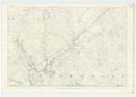
016 | [Situation] About 7/8 mile N.W. [North West] by North of Knockman Loch. A Sheet of water about 3 Miles in Circumference & lying on the farms of Duchrae Kilnare & Glenshimeroch. It serves its Source principally from Springs within itself, and other small tributaries the principal of which is "Kilnare Burn". On an Islet in its centre stands the ruins of a fortified Castle which belonged to the Gordons, "Lords of Lochinvar" subsequently Viscounts Kenmore. In very dry Weather the Castle can be gained by wading upon two narrow paths leading from the North & West sides of the Loch, these are supposed to be roads which formerly led to it. This Loch abounds with a famed species of red Trout. |
Continued entries/extra info
[Page] 11Parish of Dalry
Transcribers who have contributed to this page.
IanMcC
Location information for this page.
Linked mapsheets.