OS1/20/35/9


| List of names as written | Various modes of spelling | Authorities for spelling | Situation | Description remarks |
|---|---|---|---|---|
| ALLWHILLAN (In Ruins) | Allwhillam (In ruins) Allwhillam (In ruins) Allwhillam (In ruins) Allwhillam (In ruins) Allholme |
William Arthur John Barbour John McCaul Robert Hope Ainslies Map. |
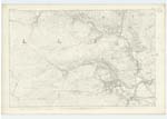
015 | [Situation] About 45 chs [chains] E. [East] of Clenrie. The ruins of a house on the farm of Drumbuie It had been Occupied by a Shepherd of Drumbuie farm, not Known in the locality how it got the name. |
| KNOCKMULLOCH | KnocKmulloch KnocKmulloch KnocKmulloch |
William Arthur John Barbour John McCaul |
015 | [Situation] About 3/4 mile E. [East] of Clenrie. A small hill on the farm of Largmore the Surface of which consists of heathy pasture. |
| STROAN HILL | Stroan Hill Stroan Hill Stroan Hill Stroan Hill |
William Arthur John Barbour John McCaul Ainslies Map 1820 |
015 | [Situation] About 1/2 mile S.E. by E. [South East by East] of Clenrie. A large hill on the farm of Drumbuie the Surface of which is rocky heathy pasture. |
Continued entries/extra info
[Page] 9Parish of Kells
Form 136
Page 25- Allwhillam
26 - Knockmulloch
26 - Stroan Hill
[Note Stroan Hill] -- "Strone - A hill that
terminates a range;
the end of a ridge. from
the Gaelic Srow. the nose
also Signifying what projects etc
Transcribers who have contributed to this page.
Chr1smac -Moderator, Moira L- Moderator
Location information for this page.
Linked mapsheets.