OS1/20/33/13


| List of names as written | Various modes of spelling | Authorities for spelling | Situation | Description remarks |
|---|---|---|---|---|
| DRUMREARIE | Drumrearie Drumrearie |
Henry Johnston James McAdam |
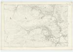
015 | [Situation] About 7/8 mile N.W. [North West] by North of Stranfasket. A Small hill on the farm of Nether KnocKreoch the soil of which is arable land.- |
| PULHARROW BURN | Pulharrow Burn Pulharrow Burn Polharrow Burn |
Henry Johnston James McAdam Ainslies Map 1820 |
015 | [Situation] Running in an E.S.E. [East South East] direction passing between Drumgowan Wood & Nether KnocKreoch & past the N.E [North East] side of Stranfasket Wood. A Considerable Burn running out of Loch Harrow Loch Minnoch & Loch Dungeon (from the former it took its name) and flowing in an Easterly direction through the farms of Bush Burnhead DucKieston & Knocknalling to its Conflux with the Water of Ken a little below Pulharrow Bridge in its Course it receives Several Small tributaries the most Considerable of which is Called Crummy Burn of which See description. |
Continued entries/extra info
[Page] 13Parish of Kells
Form 136 Page
43 Drumrearie
45 Pulharrow Burn
Transcribers who have contributed to this page.
Chr1smac -Moderator, DANIALSAN
Location information for this page.
Linked mapsheets.