OS1/20/32/12


| List of names as written | Various modes of spelling | Authorities for spelling | Situation | Description remarks |
|---|---|---|---|---|
| KELLS RANGE | Kells Range Kells Range Kells Range Kells Range Kells Range Kells Rins |
Robert McMillan Palgowan James McGeoch Craignell John Murray Craigencallie Gazetteer of Scotland 1832 Sinclairs Stat. Acct. [Statistical Account] Vol [Volume] 4 page 262 Grose's Antiquitie's page 19A Vol [Volume] 2 |
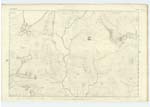
014 | A large range or chain of Mountains extending from the Black Water of Dee or River Dee at Craigwhannel in an Easterly direction for about 9 or ten Miles through a bleak & thinly populated Country. Their Surface Consists chiefly of rocky heathy pasture, but proceeding towards Carsphairn the seen to be clad more with herbage, & less heath & rocks nor on its Western end There are several portions of it & Objects on it. Known by destinctive names Such as Craigwhannel, Myleas, 'Rocking Stone &c ' all of which see their respective descriptions. In Sinclairs Stat. Acct. [Statistical Account] is the following notice "On the West and North end of the parish, the hills are still higher Covered with grass but of a bad quality, these hills are Called Kells Range and are seen at 40 miles distance; so high that there is Snow upon them for 8 and sometimes 9 months in the year. "They are the ridge or the highest land in Galloway, as a proof of this the Rivers Ken & Dee which rises on the E. [East] side run to the S.E. [South East] Sea at Kirkcudbright, and the Dun which rises on the N. [North] West side of these runs to the Sea near Ayr. These are a part of a range of hills running from W. to E. [West to East] by Lead Hills the whole breadth of Scotland |
Continued entries/extra info
[Page] 12Parish of Kells
Transcribers who have contributed to this page.
Chr1smac -Moderator, DANIALSAN
Location information for this page.
Linked mapsheets.