OS1/20/30/10


| List of names as written | Various modes of spelling | Authorities for spelling | Situation | Description remarks |
|---|---|---|---|---|
| ALTIBRICK STRAND | Altibrick Strand Altibrick Strand Altibrick Strand |
John Murray R. McAdam David Hope |
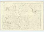
014 | [Situation] Flowing in a S. [South] direction from the W. [West] of Scabbed Craigs. A Stream or small burn taking its rise on the South Side of North Gairy Top, and running in a Southerly direction to its confluence with Hause Burn. |
| MILLFIRE | Millfire Millfire Mill Fire |
John Murray R. McAdam Ainslies Map |
014 | [Situation] About ½ mile W. by N. [West by North] of Loch Dungeon. A considerable hill or mountain on the farm of Bush, its Surface Consists of rocky heathy pasture. On its Summit is a Trigl. [Trigonometrical] Station] Called by Trigl. [Trigonometrical] Party 'Mulfire or Buss,' This is one of the hills which forms Kells Range. |
Continued entries/extra info
[Page] 10Parish of Kells
Form 136 Page
31 Altibrick Strand -- Alt nan breac, The Stream abounding in trout
32 Millfire -- Millfire from the Gaelic 'Maol fuar' i.e. The cold bare Summit or hill.
Transcribers who have contributed to this page.
Chr1smac -Moderator, DANIALSAN
Location information for this page.
Linked mapsheets.