OS1/20/3/9


| List of names as written | Various modes of spelling | Authorities for spelling | Situation | Description remarks |
|---|---|---|---|---|
| PETILLERY HILL | Petillery Hill Petillery Hill Petillery Hill Petillery Hill Petillery Hill Petillery Hill |
William DicKson William Wilson Alexander Shaw James McCrae James Sloan Robert Wilson |
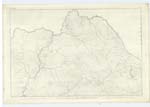
002 | [Situation] About 2 1/2 miles NE by N [North East by North] of Waterhead farm house A Small hill on the farm of Moor, its Surface is heathy pasture. On it is a Trigl.[Trigonometrical] Station called by Trigl.[Trigonometrical] Party "Moorlock". |
| SHALLOCH BURN | Shalloch Burn Shalloch Burn Shalloch Burn |
William DicKson William Wilson Ainslies Map |
002 | [Situation] Running in an westerly direction, receiving Rowantree Burn & passing Branit Moat & runs into Water of Deugh 1 1/2 N E [North East] of Waterhead farm house A considerable Stream or burn having its rise on the Southern base of Polwhat Rig, and running in a * Easterly direction to its confluence with the "Water of Deugh". |
| ROWANTREE BURN | Rowantree Burn Rowantree Burn |
William DicKson William Wilson |
002 | [Situation] Flowing from Waterhead Hill into Shalloch Burn 1 7/8 miles N E [North East] of Waterhead A Small Streamlet having its rise on Waterhead Hill, and running in a Northwesterly to its conflux with Shalloch Burn. |
Continued entries/extra info
3[Page] 9
Parish of Carsphairn
Form 136.
Page 21 Petillery Hill;
page 22 Shalloch Burn;
page 21 Rowantree Burn
[Note] Rowantree. The Mountain Ash
Transcriber's notes
* Surveyor has wrongly changed his direction of flow to EasterlyTranscribers who have contributed to this page.
Chr1smac -Moderator, Gerald Cummins
Location information for this page.
Linked mapsheets.