OS1/20/26/35


| List of names as written | Various modes of spelling | Authorities for spelling | Situation | Description remarks |
|---|---|---|---|---|
| KIRRIEMORE HILL | Kirriemore Hill | Robert McMillan N&S Palgown Newton Stewart Robert Wilson N, Culsharg Newton Stewart |
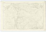
013 | A tolerable Sized hill on the farm of Kirriemore (hence the name) the Surface of which is RocKy Pasture on its Summit is a Trigl. [Trigonometrical] Station called by Trigl. [Trigonometrical] Party Catty-Moor Int. [Intermediate] This hill is the Lowest of a range of Hills diverging from the MerricK Westwards. towards the Water of MinnocK . |
| MULHAGENY BURN | Mulhageny Burn | Robert McMillan N&S Palgown Newton Stewart Robert Wilson N, Culsharg Newton Stewart | 013 | A Small Stream gathering on the farm of Palgown and off the Braes of Mulhageny (hence the name) and flowing in a Westerly direction to its influx with KirKennan Burn Convenient to KirKennan in Ruins |
Continued entries/extra info
List of Names collected by John Bray C.A. [Civilian Assistant] 1st. Examiner -- [Page] 35 -- Parish of Minnigaff -- Plan 13B. Trace 2Object - Kirriemore Hill - A Hill
- Mulhageny Burn - A Stream
[Signed] John Bray C.A. [Civilian Assistant] July 7th. 1849
Transcribers who have contributed to this page.
Chr1smac -Moderator
Location information for this page.
Linked mapsheets.